
Buitenpost - Veenklooster | Circular Walk 6 of the Bonifatius Kloosterpad Monastery Route
The leafy village of Buitenpost was built in the Middle Ages. From here you walk along the narrow De Swadde river that marks the municipal border to the village of Veenklooster.
The village of Veenklooster was built on a sand ridge. Its elevated location in a tidal landscape with peat bogs nearby made it strategically important. For a long time, this was the northernmost forest in the Netherlands. This was why the Norbertine monks established Olijfberg monastery here. The village grew up around the monastery.
The monks and nuns originally lived austere lives on the same site. Later the monks moved to Monckehuys, an outlying estate belonging to the monastery near the hamlet of Westerburen. Noblewomen who had taken religious orders remained at Olijfberg monastery until 1579.
After Hanenburch…
The leafy village of Buitenpost was built in the Middle Ages. From here you walk along the narrow De Swadde river that marks the municipal border to the village of Veenklooster.
The village of Veenklooster was built on a sand ridge. Its elevated location in a tidal landscape with peat bogs nearby made it strategically important. For a long time, this was the northernmost forest in the Netherlands. This was why the Norbertine monks established Olijfberg monastery here. The village grew up around the monastery.
The monks and nuns originally lived austere lives on the same site. Later the monks moved to Monckehuys, an outlying estate belonging to the monastery near the hamlet of Westerburen. Noblewomen who had taken religious orders remained at Olijfberg monastery until 1579.
After Hanenburch, you walk along Ulkeloane: an old sandy track across peatland towards the former male monastery. Mûntsewei, which means ‘monks road’, was the road that connected the male and female sections of the monastery. You take this road back to Fogelsangh State country house and estate.
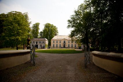
The States of Friesland sold the land on which Olijfberg monastery was built to the Fogelsangh family. Fogelsangh State country house and estate is named after the family. The estate dates back to the 19th century when the gardens that formed the basis for Veenkloosterbos forest were further developed by the famous landscape architect Lucas Pieters Roodbaard.
You make your way back to the village of Buitenpost, passing the winding De Swadde river a second time.
Sights on this route
Starting point
Stationstraat
Buitenpost
Navigate to starting point
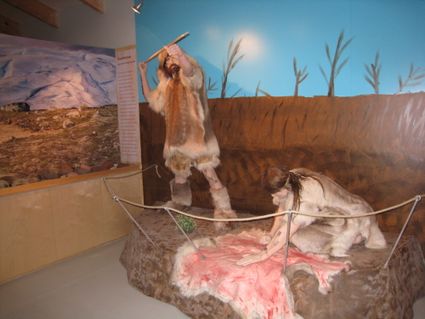
IJstijdenmuseum
Het IJstijdenmuseum is een archeolgisch museum. De steentijd archeologie van na de Saale IJstijd (130.000 jaar geleden) heeft een plekje gevonden in het museum. Meegevoerde zwerfstenen vanuit de Schandinavische landen kregen in de bodem van Noord Ned...
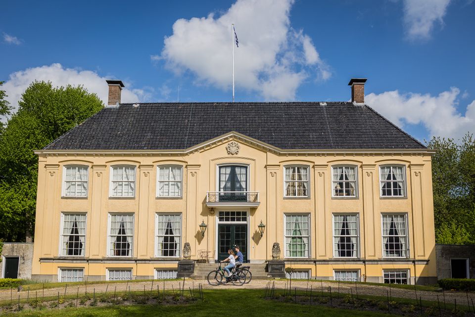
Fogelsangh State Country House and Estate
Fogelsangh State is a country house and estate in Veenklooster that is open to the public.
Fogelsangh State Country House and Estate
Fogelsangh State Country House and Estate
Kleasterwei, 3
9297 WR Veenklooster
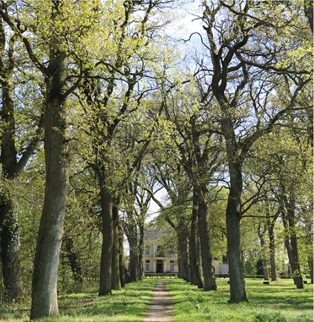
Veenkloosterbos Forest on Fogelsangh State Country Estate
The wooded parkland around the country house on the Fogelsangh State estate is absolutely enchanting. It brought fame to the landscape architect who designed it.
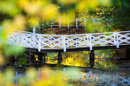
Veenkloosterbos Forest on Fogelsangh State Country Estate
Veenkloosterbos Forest on Fogelsangh State Country Estate
Kleasterwei 3
9297 WR Veenklooster
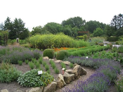
De Kruidhof
On an area of nearly 4 hectares, you will find the largest botanical garden in Friesland. Enjoy 19 magnificent theme gardens, including the largest botanical collection of (medicinal) herbs in Western Europe.
Directions
Met rug naar station Buitenpost rechtsaf (56), Stationsstraat oversteken, Schoolstraat en vervolgens streekpad volgen tot aan Groningerstraatweg rechtsaf, vervolgens rechtsaf Egypte, voor viaduct rechtsaf spoor over, om boerderij heen, fietspad volgen. linksaf tunneltje onder weg door (22), linksaf en rechtsaf Poelepaad. Op knooppunt 40 rechtsaf naar 25, op weg Hanenburch rechtsaf.
In Veenklooster (25) linksaf Voorstraat en rechtsaf Ulkeloane, einde (46) rechtsaf naar de Triemen en rechtsaf Mûntsewei. Linksaf Fogelsangloane (34). rechtsaf Pibo van Domapaad (38), einde linksaf (52) door tunnel en rechtdoor W.H. van Heemstraweg terug naar het treinstation. (56)
- 56
- 22
- 40
- 25
- 46
- 34
- 38
- 52
- 56