
Oldeberkoop - Bontebok | Section 9 of the Bonifatius Kloosterpad Monastery Route
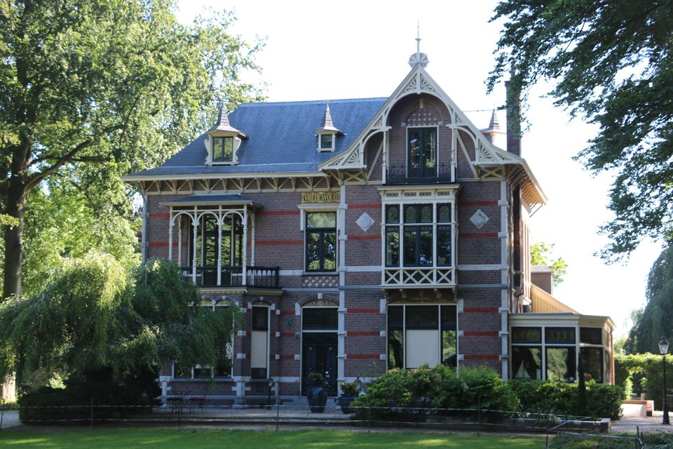
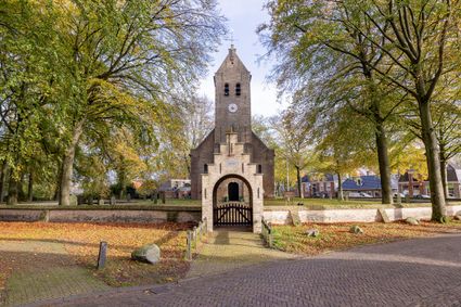
This section of the Bonifatius Kloosterpad Monastery Route starts in the village of Oldeberkoop, which became home to the nobility. At the centre of the village there is the old Bonifatiuskerk church. The gatehouse and surrounding yellow brick wall add to the beauty of the church. The village is situated on a high sand ridge between the Lende and Tjonger river valleys and was an early settlement. In the days when there were large landowners, members of the Willinge Prins family built country estates and planted forests here.
Molenbosch road leads you out of the village and into the Tjonger valley. Continue parallel to the river into the Katlijker Schar nature reserve.
On Katlijkerheide heath you ar…
This section of the Bonifatius Kloosterpad Monastery Route starts in the village of Oldeberkoop, which became home to the nobility. At the centre of the village there is the old Bonifatiuskerk church. The gatehouse and surrounding yellow brick wall add to the beauty of the church. The village is situated on a high sand ridge between the Lende and Tjonger river valleys and was an early settlement. In the days when there were large landowners, members of the Willinge Prins family built country estates and planted forests here.
Molenbosch road leads you out of the village and into the Tjonger valley. Continue parallel to the river into the Katlijker Schar nature reserve.
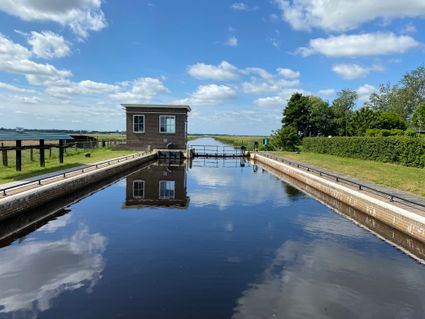
On Katlijkerheide heath you are likely to run into a shepherd with a flock of sheep as you make your way towards the little village of Bontebok, which developed at the crossing point of a country road and a waterway.
Locations on this route
- 27
- 20
- 14
- 15
- 23
- 22
- 21
- 80
- 71